Maps, Routing and Geospatial Data
Enhance your understanding of spatial relations.
Improve your logistics with Route AI.

Enhance your understanding of spatial relations.
Improve your logistics with Route AI.
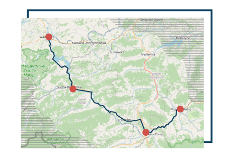
Custom logistics application often require built-in routing engine. External API solutions are expensive and their licensing sometimes forbid application in proprietary software or reselling them.
We build custom software basing on open source OSRM routing engine, and not only it is scalable, fast and accurate, but also gives full freedom with customizability and extending it with additional data sources.

Location based clustering and inference are very important tasks in a sales funnel, customer churn, or marketing optimisation pipeline. Learning about how far is too far for your customer, how much you would save choosing the suppliers basing on their location or optimising new warhouse or shop locations while expanding your business - these are examples of location-related inference.

Data Science dashboards with GIS data
A lot of analytical applications require processing of spatial data. Wheter it is agriculture, economics or business intelligence, geographical representation is often critical to draw proper conclusions and understand the data.
R Shiny or D3.js are most feature-rich frontend technologies for such application, enabling for fast prototyping and quick development of rich and interactive interface for wrangling GIS data, seamlessly integrated with various APIs.